


Discover the Power of Precision: FloodMapp's Validation Report
FloodMapp's cutting-edge technology is transforming how we predict and respond to floods. Our validation report unveils proven accuracy and impactful real-world applications that are making a difference. Download the report to see how our state-of-the-art models lead the industry in flood management and emergency response.

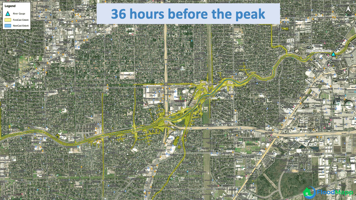
Story Maps
Dive into the dynamic world of live flood forecast dashboards. In this immersive experience, we bring you real-time intelligence during flood events.
These dashboards, built in Esri's ArcGIS platform, seamlessly integrate live predictive data and map-based storytelling to provide a comprehensive view of flood conditions and impacts.


Featured in The Climate Resilient Infrastructure Report
We're thrilled to be spotlighted in "The Climate Resilient Infrastructure Report: A Focus on Technology"—published by the International Coalition for Sustainable Infrastructure — where our collaboration with the City of Norfolk is featured. Our innovative flood risk management solutions are recognized on page 84 for helping communities adapt to increasing flood risks efficiently and sustainably.


Podcast
Building a Safe Future.
Check out our podcast where we chat with industry professionals about the struggles they have faced, the role technology plays, and innovative solutions.


Already a customer?
At FloodMapp, we're dedicated to your satisfaction. Need assistance? Our experienced staff are ready to help.
Submit a support request for tailored assistance with any issues or to share your feedback. Your satisfaction is our priority, and we're committed to resolving your concerns promptly.
Reach out today and let us assist you in ensuring a positive experience with FloodMapp.

