
Critical Moments: How FloodMapp Boosts Flood Resilience Amid Today's U.S. Flood Crisis
- Aug 12, 2025
- 4 min read
A Summer of Flood Emergencies
Summer 2025 will long be remembered for devastating floods across Texas, North Carolina, and much of the Mid-Atlantic region. In Central Texas, intense storm-induced flooding led to catastrophic flooding, tragic loss of life, and widespread rescues. These devastating impacts will be felt for years to come. Meanwhile, heavy rainfall in North Carolina prompted swift water rescues around Chapel Hill and Durham, and an atmospheric river event brought more than a foot of rain to the Mid‑Atlantic region, sending rivers surging past their banks in Virginia and surrounding states.
These rapid-onset disasters highlight the urgent need for predictive, adaptive flood intelligence. We recognize and commend the tireless efforts of emergency management teams who responded under challenging conditions. It’s a difficult job, made even more challenging in the face of uncertainty. We believe advanced flood forecasting and monitoring tools for situational awareness—ForeCast, NowCast, and PostCast—help empower emergency officials, first responders, public safety crews, utility operators, and local leaders with actionable info when it matters most.
Using Dynamic, Impact-based Forecasts to Stay Ahead of the Storm
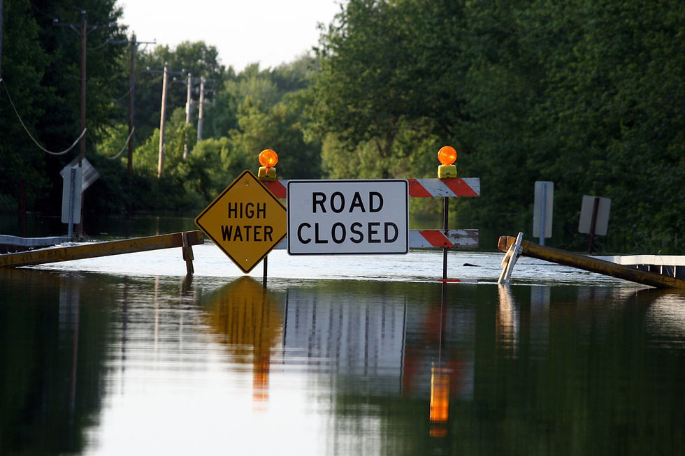
Static flood maps and outdated models simply can’t meet modern flood challenges, especially during sudden flash floods like those in Central Texas. Every flood is different, depending on factors such as coastal tide levels, where the rain falls across a catchment, or how saturated a catchment is. To tailor an effective response, Emergency Managers need dynamic, operational forecasts to understand what will happen in this flood event.
Furthermore, they need impact-based forecasts.
A meteorological forecast or hydrology forecast alone cannot answer pressing questions. Forecasting 12 inches of rainfall is valuable, but it will not identify which communities should be evacuated. Forecasting a flood height of 30ft at one gauge will not identify which roads will be cut off by floodwaters.
Emergency managers need an operational, impact-based forecast that encompasses meteorology, hydrology, hydraulics, and live impact analytics to answer these pressing questions of which people, property, and critical infrastructure will be impacted. It’s these critical answers ahead of time that provide more time to act, when moments that matter.
FloodMapp’s ForeCast tool provides precise, street-level flood predictions 72 hours in advance, enabling agencies to:
Identify areas likely to flood
Close streets before they become impassable
Alert the public
Evacuate communities
Mobilize search and rescue personnel and equipment ahead of the storm
For dynamic flood situations, early warnings can mean the difference between coordinated action and last-minute disruption. These impact-based early warnings can save lives.
Real-Time Mapping for On-the-Fly Decision Making
With rainfall intensifying by the minute, agencies need live flood data to keep responders and residents safe.
FloodMapp’s NowCast delivers real-time updates, directly to your existing GIS, on inundation and water depth. This enables teams to:
Avoid flooded streets when deploying personnel
Coordinate swiftwater rescue logistics
Maintain situational awareness through live maps
Make informed, real-time decisions that keep responders safer
Keep the public informed with detailed information
In rapidly evolving conditions, real-time intelligence helps reduce risk and build community confidence.
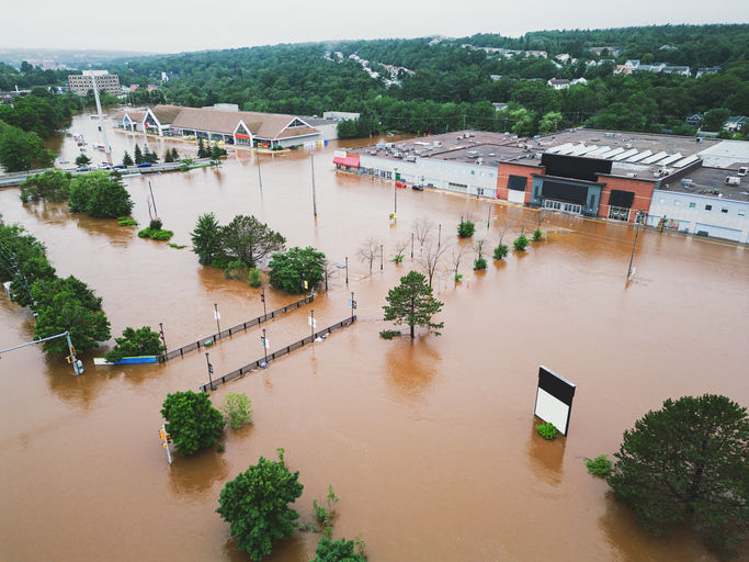
Post-Event Mapping to Support Faster Aid
After the waters recede, recovery begins, but grant applications and clean-up efforts can often be delayed due to a lack of actionable data. Manual, boots-on-the-ground damage assessment can take weeks and a lot of resources.
For lightning-fast disaster declarations and grant funding, emergency managers need impact intelligence immediately as floodwaters peak.
FloodMapp’s PostCast delivers rapid, high-resolution impact analytics along with maps of maximum flood depth and spread immediately, without waiting for satellite images, helping stakeholders:
Complete an instant, rapid preliminary damage assessment
Prioritize clean-up in the hardest-hit areas
Prepare accurate grant application and insurance claim submissions
Guide rebuilding with confidence
Detailed flood data supports faster, smarter recovery strategies.
Unite Response Efforts: Share Close-to-Real-Time Flood Info Across Departments
Flood events are multilayered, impacting public safety, transportation, utilities, and more. Without a unified view, coordination becomes fragmented.
With FloodMapp, all agencies can benefit from customizable alerts based on precise thresholds. This alignment improves response strategies and reduces inefficiencies.

Building Collaborative Resilience
Flood risks evolve dynamically, and so must our response. FloodMapp supports emergency teams and agencies by providing impact-based forecasts, predictive insights, real-time updates, and post-event clarity, which updates 24/7, 365 days a year, with the ability to integrate into existing operational workflows.
We respect and applaud the work of every emergency responder in Texas, North Carolina, Virginia, and beyond. FloodMapp is here to stand with you as a collaborative tool, enhancing resilience and response as these critical moments unfold.
Take the Next Step: See FloodMapp in Action
Schedule a demo to explore how FloodMapp can enhance preparedness, protect assets, and support your community when it matters most.

Seeing how ForeCast, NowCast and PostCast streamline every flood response stage makes me glad tools like cabnox also focus on turning complex environmental data into actionable on-the-ground guidance for emergency teams.
The detail about ForeCast giving street-level flood predictions 72 hours ahead really struck me; it's like a tower defense game planning phase, but for real communities. Seeing how they overlay real-time data to redirect traffic, I couldn't help but think about checking my weather app during my commute-what if we all had access to such precise, life-saving intel?
Powerful and timely https://citylineairconditioning.com/ article. The real-world implications of flood resilience were explained with clarity and urgency. It reminded me of a risk-awareness discussion I came across on citylineairconditioning that also focused on practical impact.
Really important information here your https://qualityfenceandcustomoutdoors.com/ breakdown of how FloodMapp helps recovery was very clear. I came across a qualityfenceandcustomoutdoors article that focused on resilient outdoor design too, which linked well to this topic.
This was a very informative and https://mirianlaw.com/ timely piece. I appreciated how clearly the real-world impact of flood data and preparedness was explained. I came across a related discussion on a mirianlaw-based blog recently, and it complemented the points made here quite well.