
Does El Niño reduce my flood risk?
- Feb 27, 2023
- 3 min read
There is a common perception that once the current weather pattern moves from La Niña to El Niño (the ENSO cycle), the flood risk that the eastern states of Australia have been facing will pass.
Is the sigh of relief warranted?
The Bureau of Meteorology has released its long-range forecast which shows we are still in an active La Niña phase, with models indicating a move towards neutral or El Niño status.

We know that ENSO phases are not the only factor in whether floods will occur, nor are they the silver bullet predictor. Regardless of the climate pattern, it is important to remain ever vigilant. Floods can and will occur irrespective of the long-range forecast. Changes in forecasts should not lead to complacency and short-term memory loss about the devastating impacts of flooding.
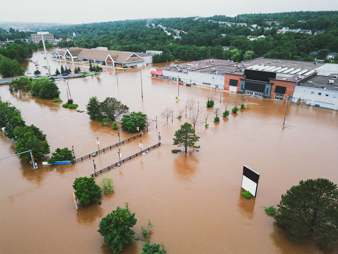
To demonstrate this point, let’s look at a section of gauges across Queensland and New South Wales to understand the data on the number of flood events, that exceeded moderate levels, in the context of the ENSO climatic phase that those events fell within (image 2).

Image 2: Comparison of gauges across Queensland and New South Wales
Some of the largest events on record and clusters of events fell during La Niña phases however there were still a significant number of events which occurred outside of La Niña phases.
All flood events have the ability to disrupt critical infrastructure, damage properties and cause distress to communities. All floods demand that emergency managers are prepared and have the plans and tools to respond and recover. It is equally important that this planning, preparation and operational readiness is consistent, irrespective of assessments of weather patterns. Understanding the ENSO cycles can be useful but the evidence says floods can occur at any time.
When taking a closer look at a selection of gauges, the number of events and magnitudes differ, however there is a consistent theme - irrespective of the ENSO phase, floods still occur.
Looking at examples such as Ipswich, Queensland (image 3), notable floods in 2009, 2013, and 2017 all occurred during neutral or climate phases that were shifting towards El Niño.

Image 3: One Mile Bridge Gauge, Ipswich, QLD
The same is true for Warwickand the other 35 gauges we selected at random across Queensland and New South Wales (image 4).

Image 4: Condamine River Gauge, Warwick, QLD
What does this mean? Simply, the need to be prepared, act and respond doesn’t change with the climate phase we are in.
It is interesting that when we, as a community, perceive our flood risk to be lower, we often don’t put an emphasis on implementing or further developing our operational tools.
The frequency of flood events can significantly contribute to the average annual damage experienced for assets or the community. Being able to make tangible reductions in damages for all events, big and small, can significantly improve overall resilience.
Furthermore, less intense wet seasons without back-to-back catastrophic flooding, like we saw in 2022, also provides a beneficial environment to make system improvements, test new approaches, and develop updated processes. This is the optimal environment to train, conduct exercises and have open dialogue regarding lessons learnt and what is and isn’t working.
So, while Australia looks to possibly transition into El Niño, we encourage you to take advantage of this time to evaluate your flood preparedness, response and recovery processes and capabilities.
Real-time situational awareness 24/7/365, irrespective of the climate outlook, is key to being prepared for whatever the weather throws at us.
If a common operating picture, real-time situation awareness or predictive flood intelligence is something you’re lacking, please contact us to learn more about how FloodMapp can assist via sales@floodmapp.com


Fantastic piece! This is exactly the kind of thoughtful, well-researched reporting we need more of. 소액결제 현금화 Really appreciate you bringing this important story to light!
Great piece! I really appreciate how you covered all the important angles on this story while keeping it accessible and engaging. 정보이용료 현금화 Keep up the excellent work!
This is a very informative and practical explanation of how El Niño can influence flood risk, especially in different regional conditions. The way you explained the topic was very clear and helpful. I recently came across a similar discussion on a review blog, and it offered an interesting perspective as well. It also reflects how data-driven platforms like https://gocollectiv.com/ often highlight the importance of understanding environmental patterns to better prepare for climate-related challenges.
I appreciate the depth of research and clarity in your writing. This piece provides a fresh and compelling take on the subject. goo goo gaga clicker
This was a very informative and well-balanced article. I appreciated how clearly you explained that weather patterns like El Niño don’t automatically eliminate flood risks and that preparedness should always remain a priority. The real examples and practical perspective made the post especially valuable. I also read a related discussion recently on a review blog called https://www.goprogaragedoorrepair.com/, and it highlighted a similar point about staying proactive rather than relying on assumptions. Excellent insights throughout the article.