

What's Included


Custom Dashboard Features
Everything you need, in one place.
From road or building impacts to post-event damage assessments, see the information you need —when you need it.


What You Can Do
Before • During • After
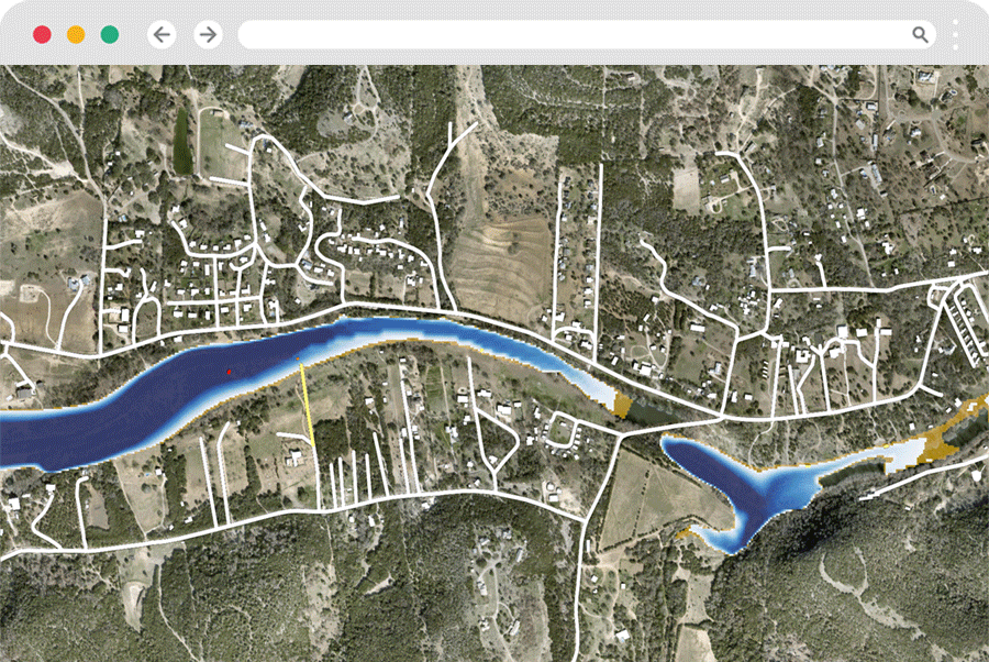
When a system is 24–72 hours out, do you know which streets, facilities, and communities will flood—and how deep? FloodMapp PREPARE turns forecasts and live data into street-level inundation and depth in your GIS, so you can:
Before (hours to days)
Draw targeted evacuation polygons; send localized alerts, schedule barricades at low points; pre-stage pumps, sandbags, and rescue crews; safeguard substations and lift stations likely to flood.
See it for yourself
Operational Flood Forecasting
From Hydrograph to
Street-Level Forecast
Forecast hydrology models run hourly to predict flood peak and timing; FloodMapp converts that signal into GIS-ready extent, depth, and impact—so you know where, when, and how deep flooding is likely.


Best Fit For
Public safety and emergency management, transportation operations, critical infrastructure operators, communications/network operators, and organizations responsible for distributed assets and services across the USA and Australia.
Made for Teams That...
Need hours-days of lead time to prepare for flood events
Draw targeted evacuation zone polygons and issue targeted alerts
Pre-position resources and protect high-value assets
Protect people and assets across neighborhoods, corridors, and regions
Need to know which communities, roads, and assets are at risk of flooding (not just how much rain will fall)


Tiers, Coverage & Programs
Choose the solution that matches your needs. All packages deliver GIS-native live layers; tier differences focus on coverage, access, refresh options, and support.


(3 Steps)
How It Works
-
Connect: Access FloodMapp's live mapping feed.
-
Update: Overlay FloodMapp layers in your GIS platform to assess localized impact.
-
Share: Update your community in advance with confidence.


