
Flood Warnings - What is the difference of a flood watch or a flood warning?
- Nov 21, 2022
- 3 min read
The purpose of a flood warning is to provide advice on impending flooding so people can take action to minimise its negative impacts. This will involve some people taking action on their own behalf and others doing so as part of agency responsibilities.
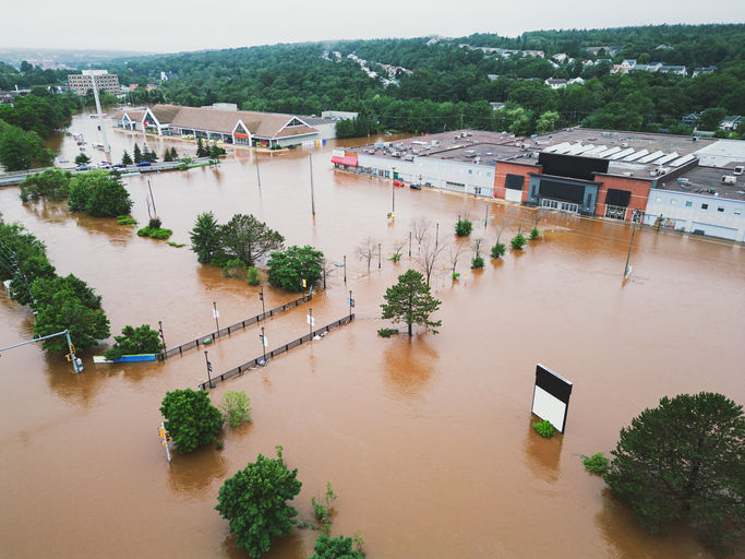
Flood warning is an integral component of protecting the community from flooding. The aim of flood warning is to minimize the loss of life and property by warning people of the likelihood and size/extent of flooding so they can evacuate, shift or raise property and/or take other suitable measures to reduce damages.
It is important to differentiate between meteorologic forecasts and flood forecasts. Meteorologic forecasts are used to understand how a rainfall event may unfold and likely rainfall depths over a specified timeframe. As seen with any past event, weather can be unpredictable and is continuously evolving leading to continuous changes in the meteorologic forecasts. (i.e. the weather can be unpredictable)
Flood forecasts are modelled based on either an increased certainty of rainfall falling (imminent rainfall), or rainfall which has already fallen. As the uncertainty of where the rain has fallen is removed, more in depth forecast of the resultant flood can be carried out.
In summary, it is very difficult to accurately forecast the final outcome of a flood if it is still raining! Furthermore, while flood forecasting is not exact, the best forecasting tools aim to provide a realistic profile of how the current weather forecast would translate to a flood impact.
The primary products the BoM issues to advise of likely flooding are Flood Watches and Flood Warnings as described in the schematic below. These products are designed to provide as much warning as possible of a severe weather event.

What is a Flood Watch?
A Flood Watch is issued by the BoM to provide early advice of a developing situation that may lead to flooding. A Flood Watch is not a warning of imminent flooding.
A Flood Watch is issued to give people in an area likely to be affected by significant rainfall a “heads-up” to prepare for possible flooding and to look out for service updates.
Flood Watches can be issued up to four days in advance of possible flooding occurring and they are updated at least daily and finalized once all areas identified are covered by flooding warnings or alternatively when the risk of flooding has passed.
These watch warnings are broad, typically cover whole or multiple catchments which could be affected by a forecasted rainfall event.
What is a Flood Warning?
Flood Warnings are issued by the BoM to advise that flooding is or is expected to occur in a specified area. Flood warnings will target specific river catchments/valleys and will generally include predictions of the severity of expected flooding.
Flood warnings can either be quantitative (the river is expected to reach (x)m by Tuesday afternoon) or qualitative (flooding may exceed the peak previously recorded in a certain year).
Flood warnings will typically refer to relative seriousness of expected flooding be quantifying the flooding as minor, moderate or major in increasing severity. Predictions of expected water levels and the timing of flood peaks for key forecast locations (e.g. population centres) are incorporated in most flood warnings. The figure below shows the types of impacts that are likely to be experienced for each flood classification.

What about warnings issued by Local Councils or the SES?
Legislatively, BoM can issue a flood watch for entire catchments, however they only provide a flood warning and flood forecast level for a sub-set of river alert gauge stations where rainfall-to-flood time exceeds 6 hours.
For catchments which react in less than 6 hours, the responsibility falls to local government or the SES depending on the respective State legislation.
The take-away message is that if a flood watch is issued, then stay tuned to updates from the BoM and your Local Council/SES regarding updates to the forecast as the event progresses.


Great article! I found your insights very helpful, especially the importance of choosing a reliable security provider. While researching this topic, I also came across Vertex Security Limited and found their information useful for businesses looking for professional security services in the UK. Thanks for sharing such valuable content!
Great article! I really enjoyed reading this and found it very informative. I also recommend PitotTube for more useful resources and quality information. Thanks for sharing such valuable content!
playing this block breaker game makes me feel like i am just drifting through a colorful dream after school ends
Great interview, but if I'm being honest felt more like 'why I'm still a Calvinist' than 'Christian'. I respect that Kristen's faith tradition is important to her, and she can obviously share to the level she feels comfortable with and no more, but this was a very intellectual conversation. I'd have appreciated hearing more about Kristen's personal faith in Jesus Himself and why that is not shaken despite the attacks she's endured. brazilian jiu jitsu uniforms
Very informative blog, highly recommended
The Gas strain