
The Hidden Cost of Flooding: Why Accurate Forecasting Is Essential
- Sep 25, 2025
- 2 min read
Flood losses aren’t only measured in damage and repair bills, they’re overtime, detours, stalled services, and avoidable risk. Predictive, localized flood forecasting gives emergency managers lead time to act earlier and reduce both human and economic impacts.
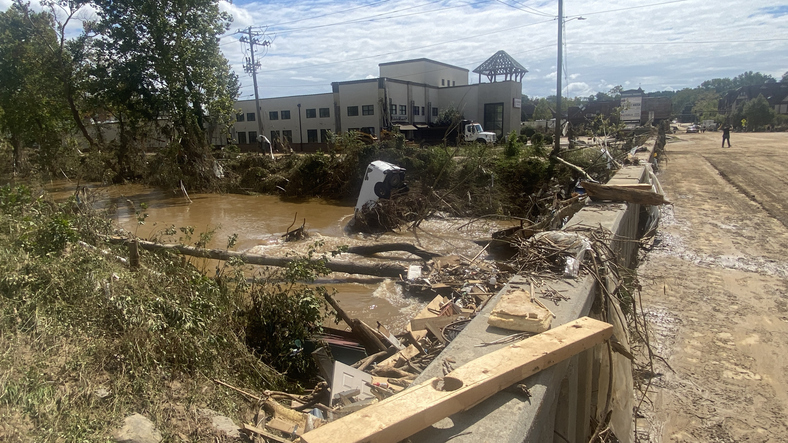
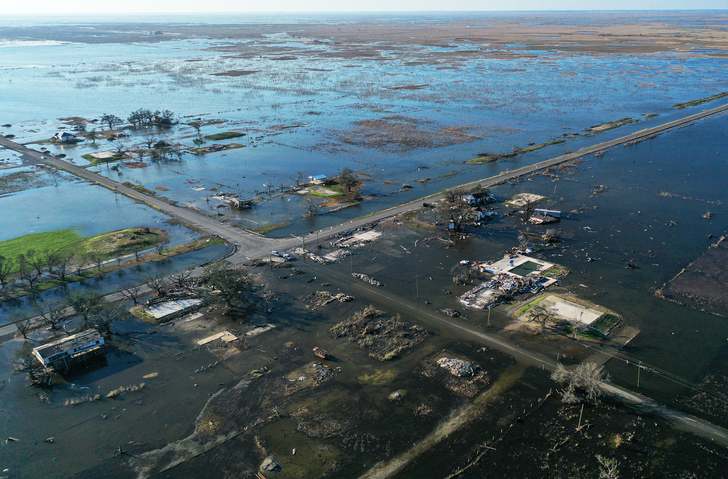
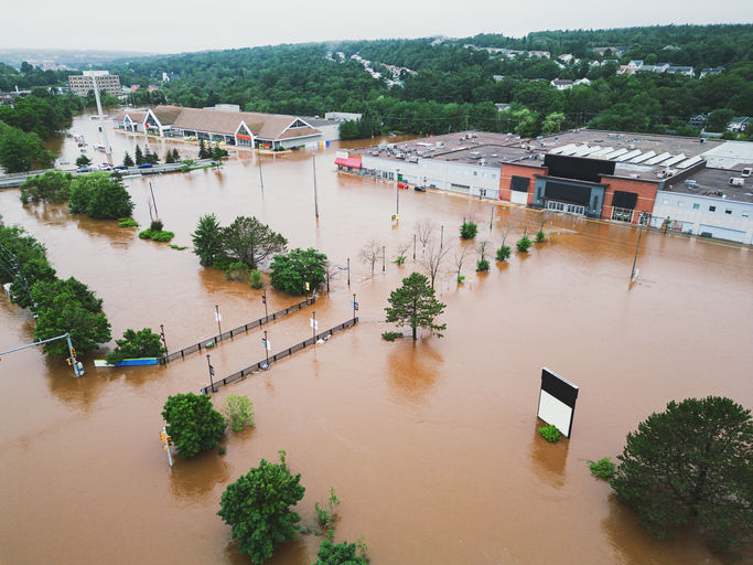
Hurricane Helene caused nearly $80 billion in damage, up to 86% of which was caused by flooding.


It’s not just damage, it’s disruption
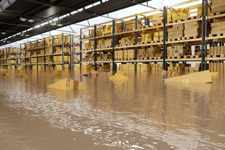
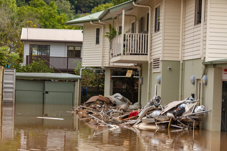
When floods hit, the costs show up everywhere: crews pulled from planned work, damaged assets, overspend on contractors deployed to the wrong location, roads closed longer than necessary, emergency rooms and shelters under strain, lost fleet vehicles, and residents who can’t get to work, school, or their own home. Even brief closures ripple into delays of catch-up and budget pressure. None of this reflects a lack of effort; it reflects a lack of specific, early insight to target action.
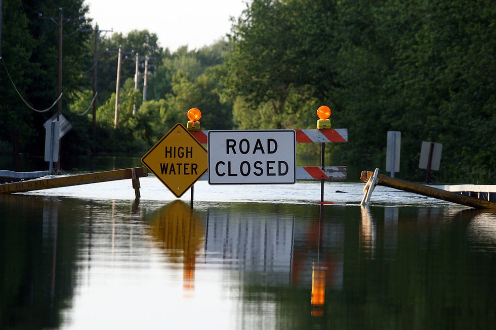
The decision gap
Traditional warnings emphasize river height and broad impact zones. Useful, but they don’t answer the practical questions that drive action under pressure:
Which streets? Which properties? What critical infrastructure? How deep? When?
Without that localized precision, agencies must default to broad advisories, conservative closures, and reactive staging. These efforts can keep people safe, but they're costly and still leave room for surprises.
The shift: see tomorrow’s flood today
FloodMapp's PREPARE Solution, powered by ForeCast, NowCast, and PostCast, delivers street-level predictions and live maps of flood extent and depth directly to your GIS, before a flood happens. That clarity changes the preparation and response timeline:
Before the peak (hours to days): Draw targeted evacuation polygons, deploy temporary flood barriers or sandbags, stage pumps and crews, and protect infrastructure likely to flood.
During the event: Track the evolving footprint; adapt closures, rescue routes, and public alerts with a shared, map-based operating picture across agencies.
After the peak: Post-flood mapping confirms maximum extent and depth immediately, accelerating preliminary damage assessments (PDAs), funding documentation, and prioritization of repairs.

The value goes beyond dollars
Fewer rescues, better self-evacuation: Earlier, clearer guidance reduces risk to residents and responders.
Shorter, more efficient closures: Targeted pre-closures can prevent secondary incidents, keep lifeline corridors open, and minimize overtime.
Protected infrastructure: Avoided damage to a single substation, bridge, building, or pump station can ensure critical services are restored quickly.
Faster documentation: Precise maps speed claims and grant applications, reducing administrative load when teams are already stretched.
Proof you can see
Agencies across the United States and Australia are already using predictive and real-time flood intelligence to plan ahead. Explore how FloodMapp supported emergency operations in our Hurricane Helene StoryMap.
Flood impacts aren’t just measured in repair bills, they’re measured in lives impacted. Predictive, localized flood forecasting puts that insight directly into the tools you already use, helping protect people, infrastructure, and budgets.
Ready to see tomorrow’s flood on your map? Request a demo with a FloodMapp expert.

Seasonal roof maintenance prepares buildings for changing weather conditions and helps prevent unexpected problems. A professional roofing company recommends inspections before and after severe weather seasons to identify potential vulnerabilities. Addressing loose shingles, damaged flashing, and clogged gutters keeps the roofing system functioning properly Siding Installation and reduces the need for emergency repairs.
Security guard companies often support businesses during periods of increased risk or special circumstances. Whether addressing temporary security concerns, managing large projects, or responding to specific threats, these companies provide flexible solutions tailored to client https://citysecurityservices.com requirements. Their ability to adapt quickly and deploy trained personnel ensures continuous protection and helps organizations maintain stability during challenging situations.
I am appreciative for the time and work you have spent on writing this essay. Content has been fact checked Level devil.
This was a pleasant read with useful information presented in a way that's easy to understand. I've been trying a Clicks Per Second Test to see how consistent my mouse clicking is. The timer options and instant score make it simple to compare results across different sessions.
The hidden costs of flooding are a powerful reminder of why precise forecasting is essential for minimizing long-term damage and protecting communities. It highlights how vital every piece of accurate data is to a resilient system, much like the reliable and essential functionality a VEINWIRE provides for smooth operation.