
The Missing Piece in Flood Recovery: How Real-time Flood Impact Mapping Accelerates Recovery Funding
- Dec 18, 2025
- 4 min read
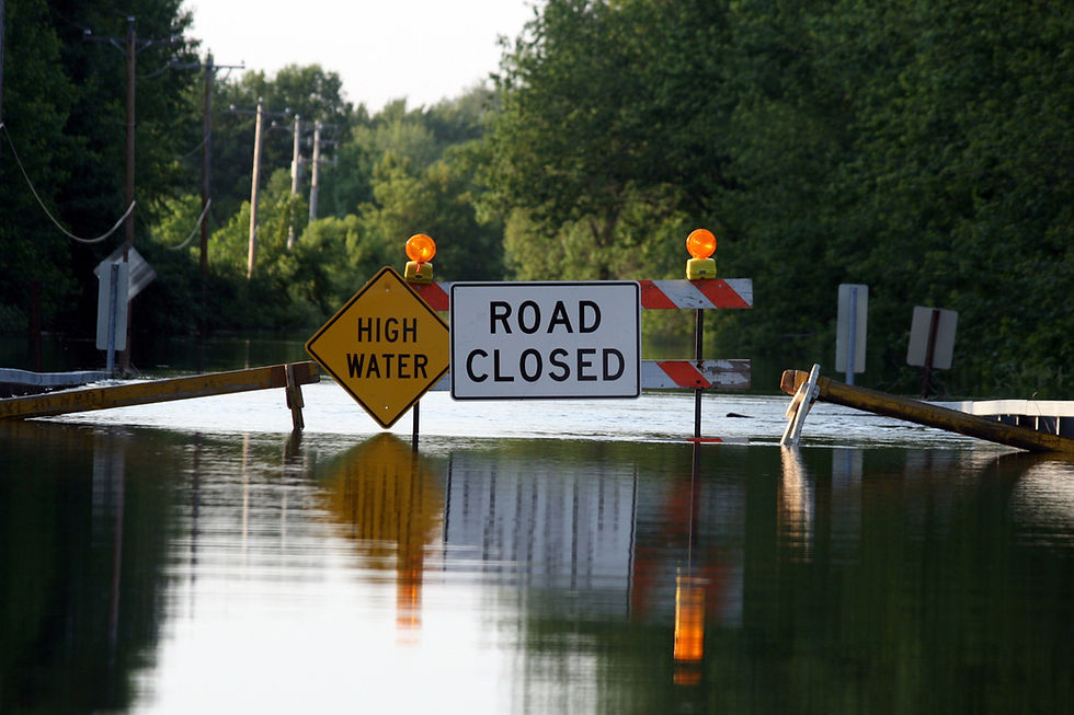
When a flood hits, response efforts are often swift: emergency teams mobilize, communities evacuate or shelter, roads close, and local agencies work nonstop to protect lives and property. But once the waters recede, an entirely different crisis begins.
Recovery.

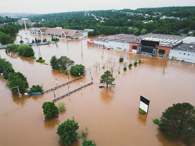
For many communities, flood recovery is the longest, most frustrating, and most resource-intensive phase of the disaster cycle. Local and state agencies must suddenly prove what was damaged, where it occurred, and how severely, all while documentation is inconsistent, satellite imagery is obscured, and resident-submitted reports vary widely. And with more than 75% of U.S. presidential disaster declarations tied to flooding, the volume and frequency of these events compound the operational burden on state recovery programs (nationalfloodinsurance.gov). In Australia, federal resilience funding through initiatives like the Disaster Ready Fund, a $1 billion national program, is highly competitive, with only a fraction of applicants selected for funding in each round despite broad demand, exposing the importance of detailed, defensible impact documentation to support grant success (nema.gov.au).
With recovery funding under increasing pressure, agencies must clearly demonstrate where flooding occurred and how severe the impact was to justify assistance. This is where impact-specific flood intelligence becomes indispensable, and it’s often the missing piece.
FloodMapp provides defensible, impact-based evidence that strengthens and accelerates Preliminary Damage Assessments (PDAs), shortens the path to recovery funding, and reduces the administrative burden on overstretched recovery teams.
The Hidden Problem: Recovery Fails When Documentation Fails
Most people assume recovery automatically begins when the flood ends. But for most state and local agencies, the real challenge is producing the documentation required to unlock the resources needed to start recovery.
To unlock funding, agencies must demonstrate:
Where flooding occurred and how severe it was
Which homes, businesses, public facilities, and critical infrastructure were impacted, and to what extent
the number of people affected by the event
Estimated damages associated with the impact
But gathering that information is extremely difficult. Traditional sources of truth break down:
Manual surveys can take days, weeks, or months to complete, delaying PDA validations and slowing access to recovery funding.
Satellite imagery is often unusable due to cloud cover, darkness, or missing the peak due to limited swath width or slow revisit times, leaving agencies without timely documentation.
Resident reports are often inconsistent, creating verification challenges and delaying financial assistance.
Government datasets frequently conflict, forcing rework and slowing approvals.
The result? Communities wait weeks or months for support. National data in the US shows the scale of this bottleneck: 71% of counties waited one to three years for reimbursement, and 28% still had claims pending after six years (naco.org).
What recovery teams need is a timely, defensible evidence base on what actually happened.
Bridging the Gap with Rapid, Defensible Flood Evidence
FloodMapp’s PostCast, included in both PREPARE and RESPOND, fills one of the most persistent gaps in recovery: fast, accurate, and defensible post-event flood mapping for funding and damage assessments.
Unlike satellite-dependent tools, PostCast generates high-resolution flood extent and depth GIS layers immediately as water peaks, regardless of cloud cover, darkness, or poor flying conditions.
PostCast delivers:
Street-level flood extent and depth mapping for precise PDAs
Immediate availability, often hours or days before satellite imagery
Consistent, defensible documentation suitable for interagency alignment
Outputs aligned with federal and state funding requirements
By replacing uncertainty with verifiable flood impact data, PostCast provides the factual foundation agencies need to initiate and justify the next stage of recovery.

Impact Analytics: Turning Flood Maps into Actionable PDA & Funding Intelligence
PostCast shows where the water went; Impact Analytics reveals what it affected. By layering PostCast’s flood depth and extent with operational datasets, including:
Residential and commercial structures
Critical infrastructure (substations, pump stations, telecom, water, energy)
Transportation networks
Social infrastructure
Custom dataset(s) available
Impact Analytics transforms raw flood mapping into property-level and asset-specific insights, such as:
Which homes or businesses were inundated
Which roads, bridges, or critical routes were impassable
Which utility assets, towers, or facilities were impacted
How many residents or vulnerable communities were affected
Estimated damages or reconstruction costs
This level of detail allows agencies to validate, dispute, or support claims quickly and confidently.
Strengthening PDAs & Accelerating Funding Timelines
Preliminary Damage Assessments are the gateway to unlocking state and federal recovery funding. But PDAs often slow down due to:
Incomplete or inconsistent damage reports
Uncertainty about whether flooding reached a property
Difficulty determining water depth at structures
FloodMapp provides a consistent, defensible dataset that helps answer the most critical PDA questions, including:
Which structures were inundated, how many were impacted, and where those impacts occurred
The severity of flooding at and around affected properties
Impacts to surrounding roads, access routes, and critical infrastructure
The breakdown of impacted structures across residential, commercial, industrial, and manufactured housing
Whether impacts reached thresholds required for assistance programs
Estimated damages across jurisdictions
With this information, agencies can quickly:
Prioritize the hardest-hit communities
Support or dispute claims with defensible evidence
Submit faster, more accurate funding applications
Accelerate recovery and mitigation planning
This means fewer delays, fewer disputes, and greater confidence across response, recovery, and community stakeholders.
Transforming Recovery Data into Long-Term Resilience
Flood recovery isn’t only about rebuilding; it's about preparing for what comes next. With validated, high-resolution flood intelligence, agencies can:
Identify repetitive-loss patterns
Strengthen hazard mitigation grant applications
Plan targeted infrastructure upgrades
Improve evacuation and emergency plans
Build transparent, trusted community messaging
Recovery data becomes resilience data, a foundation for long-term risk reduction.
Flood recovery is complex, emotionally charged, and often slowed by missing or inconsistent information. FloodMapp provides what traditional tools cannot: fast, defensible, property-level flood intelligence that accelerates PDAs, supports funding applications, and helps communities receive assistance sooner.
If your agency is navigating complex recovery workflows or preparing for future flood seasons, FloodMapp can support your efforts with clear, actionable data when it matters most.
Request a demo to explore how FloodMapp supports faster, smarter flood recovery.

Fantastic reporting! 정보이용료 현금화 This piece really sheds light on an important issue and is written with such clarity that anyone can understand it. Keep up the excellent work—we need more journalism like this!
Fantastic piece! I really appreciated how well you broke down this complex topic into understandable points. 소액결제 현금화 Keep up the excellent reporting!
Real-time flood impact mapping is clearly a game-changer for speeding up recovery funding and helping communities get back on their feet faster. For those who want to better understand the technology behind these vital insights, SearchByVideo would be an excellent way to discover informative visual explainers and demonstrations.
This article highlights a vital aspect of flood recovery—real-time impact mapping. It’s essential for efficient funding and recovery efforts. For anyone looking for a break from serious topics, I recommend trying out スイカゲーム Suika this fun and addictive game<a href="https://suikagames.net">this fun and addictive game</a> to unwind!
Reading that 71% of U.S. counties wait years for reimbursement, I realize how brainrot merge of delayed funding and bureaucratic processes cripples recovery. FloodMapp's PostCast generating maps at peak flood, regardless of clouds, is a stark contrast-it makes me wonder, over coffee, why such clear solutions aren't the norm yet.